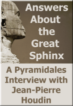
 Last week we published Part One of Marc Chartier’s interview with Jean-Pierre Houdin regarding the Great Sphinx. In that installment Jean-Pierre made the case for Khufu being the face which adorns the mighty guardian of the Memphis Necropolis. This week, in Part Two, we will be looking at the physical evidence for setting a date for the Sphinx’s construction. Enjoy!
Pyramidales:
I agree, at this point in our conversation, that for you, and to the contrary of some kind of “Pensée Unique”, the Sphinx must be related to Khufu and not to Khafre.
Do we know anything about the reason, or reasons, which led the King to add such a monument to his pyramid? What was its meaning and function? Why would the King have chosen to be portrayed with a human head and a lion body?
Jean-Pierre Houdin:
As I said previously, I think that the outcrops on the Plateau must have played an important role, the one from which the head of the Sphinx was carved having an additional particularity: its position at the lower end of the Plateau, on South/East side of Khufu’s pyramid. Don’t forget that at that time, Memphis was the capital and was erected towards the Southeast of the Plateau, a little more upstream in the Nile Valley. This situation must already have led the architects and geometers to choose the site of Khufu’s pyramid at the edge of the promontory overlooking the Valley. Doing this, the pyramid was clearly visible from Memphis. Between both, the town for the workers was set between the Hill of the Crows and the Nile, on the South side of the port which was divided into two parts: one side to supply food to the town and one side for unloading materials coming from Turah and Aswan. The main view and approach axis was from the Southeast and the closer one came to the Sphinx, the more impressive this perspective became. Thus the Sphinx appeared like a guardian of the site looking towards the East, from where the sun rises every day, announcing the rebirth of the King in an eternal cycle. The position and orientation of the rocky outcrop must have inspired its planners, and even more, don’t forget that the Giza Plateau is a huge necropolis and the idea to protect this sacred area must have been foremost in the minds of the builders.
For everything, there is always a first. Let’s say that the Sphinx launched a concept that would become a standard in all the following Dynasties. Why the body of a lion and a human head to represent the King? Certainly because the lion is seen as the King of animals (and still is today) and to give it the face of the King was symbolic, a fusion of power and royal wisdom.
I’m not an Egyptologist and I can’t swear to it, but my feelings and analysis are based on my experience as an architect which bases all reflection on the context of the builders’ time, when the entirety of this part of the Plateau was one gigantic building site.
Pyramidales :
I want to imagine how the Giza Plateau looked like at the end of Khufu’s reign, notably without the two big pyramids of his successors. We have, on the higher part on the North side, Khufu’s pyramid and the Upper Temple, and, on the East side, the Valley Temple, far from the area we are talking about, plus the Sphinx and its own Temple at the lower end of the ramp of the port. What does the Sphinx mean in the context of the landscape? If it had an essential meaning, why didn’t the other kings – Khafre and Menkaure – imitate their predecessor and built their own Sphinx? Otherwise, do we have to see this as a mark of megalomania on the behalf of Khufu?
Jean-Pierre Houdin :
At the early stage, I don’t think that the Sphinx was seen as an essential element, but rather as an additional element. The position of the rocky outcrop must have been what originally inspired the builders to create this monument there, and their motivation carried the work forward.
For me, after having meticulously studied the Plateau for years, it is evident that the Sphinx was carved under Khufu’s reign and that it bears the face of this King. So, what was the motivation for this grand addition to Khufu’s complex?
In addition to the most impressive pyramid ever built, did Khufu desire to manifest his overwhelming power and impose his mark on the Plateau with this sculpture which would turn him into God?
There must have been a plenty of advisers at the Palace for that kind of project. That would be consistent with the idea of some Egyptologists who think that the end of Khufu’s reign saw a battle with no mercy between the Royal power and the priests, with the priesthood opposing a King who was becoming a too powerful, like a living God; the priests were not willing to live in the shadow of the King.
On the opposite, some think that the Sphinx would have been built by Djedefre as a tribute to his father. I don’t believe, for many reasons, that Djedefre would have constructed the Sphinx during his own reign, which could mean that Djedefre took upon himself a regency in the last years of Khufu’s reign. Some inscriptions, being attributed to him and dating from just before the end of Khufu’s reign, have been discovered on beams covering the pit of Khufu’s Solar boat; that could give some credence to this hypothesis. Moreover, we are sure that Djedefre was in charge of Khufu’s funeral ceremonies, which implied that he was his designated successor.
Furthermore, during the Fourth Dynasty, design and construction of pyramids were more linked to the principle of evolution rather than revolution; why would the Sphinx not simply be a project planned from the beginning of the design when we look at its position at the foot of the Plateau and at the core of the building site?
Anyway, I don’t think that the carving work began in the early years. My opinion is that the first hammer and chisel strokes were done around the end of the construction of the King’s Chamber, thus around year sixteen, at the earliest, when the port was reserved for just the unloading of the Turah limestone blocks.
This geological reason could thus explain the absence of large Sphinxes for the other pyramids: no rocky outcrop, no oversized Sphinx. Otherwise, the idea to put several Sphinxes in a funerary complex did eventually happen, such as the statues that were set in place at the entrance of the Temples starting from Khafre’s reign, for example, at his Valley Temple. The fashion, if I can use this word, was thus launched.
Pyramidales :
Nowadays, the Sphinx appears to us in a particularly damaged shape. On the one hand, and accordingly to one of the retained hypotheses, its face could have received the sacrilegious shots from the Mameluks artillery. On the other hand, its immediate environment bears marks from erosion caused by rainfall and water runoff which, even if they are not frequent in Egypt, can be notably violent.
When comparing the weathered condition of the sculpture and its enclosure with other buildings on the Plateau, some people think that the Sphinx is older, perhaps much older, than the pyramids.
What do you think about such a reading of the site ?
Jean-Pierre Houdin :
A theory, proposed in the 50’s and recently back on the front stage, tries to prove that the Sphinx was already present on the Giza Plateau several thousand years before the construction of the large pyramids. This theory is supported, in its demonstration, by the analysis of the rain erosion which can be seen on the walls of the Sphinx enclosure.
Although the hydrological and geological reports are quite pertinent, in no case can the proposed conclusion stand on this single observation because two basic parameters are missing in this study: the original topography of the Giza Plateau and the upheavals resulting from the construction of the pyramids of Khufu and Khafre.
The addition of these two parameters leads to a totally opposite conclusion and strengthens the fact that the Sphinx was effectively carved at the time of the construction of the large pyramids, more precisely under Khufu’s reign, as I’m in the process of demonstrating.
After this initial introduction, I’ll allow myself, my Dear Marc, to expand a little more on this topic which requires a very detailed explanation because of the importance of my conclusion, a conclusion which fully supports everything I have been saying.
As we have already seen, The Sphinx is a monolithic sculpture directly carved from the bedrock, the head from a rocky outcrop and the body by quarrying down and around the body, creating around it a several meters deep enclosure edged by vertical walls. To summarize, the Sphinx literally springs up from its own quarry.
The erosion by wind and sand left horizontal marks of varying depth on the enclosure walls depending on the quality of the limestone stratums, while rainwater erosion, due to water runoff, cut vertical grooves on these same walls.
As one can notice on the photo above, the most noticeable rainwater erosion is found on the enclosure walls on West (in the background) and South (on left) , while the much lower wall on North (on right) is less eroded.
On both photos of the western wall below, the water runoff seems to be evenly spread along the wall, showing a regular flow of water from the overhanging quarries inserted between Khafre’s Royal Causeway and Khufu’s pyramid.
On the North side of the Sphinx enclosure (Above Sea Level 20), Khufu’s pyramid is built at a higher level (ASL60), creating de facto, with the Queens pyramids and the Royal mastabas, a barrier on this part of the Plateau. Between both, the ground slopes down toward the South as shown by the arrangement of the stratums of the western wall of the Sphinx enclosure.
Both of the photos below show the South-East corner of the enclosure and the Causeway which goes along it for a few meters. On the southern wall, one can observe the marks of the water runoff which dug deep vertical grooves into the wall.
One can also note that the enclosure was partially filled between the back of the Sphinx and the western wall.
The photo below shows the South wall as seen from the South-West corner of the enclosure, and the very close presence of the masonry (rebuilt) of the North wall of Khafre’s Royal Causeway. One can notice that in the first part, close to the South-West corner, the grooves made by the water runoff are very deep and the wall is getting closer to the Causeway in steps (the shadows highlight this phenomenon); to the contrary, in the second part, closer to the Valley Temple, the wall is much less eroded and there is no step. The water runoff didn’t erode the South wall the same way all along and the “free passage” between the wall and the Causeway is thinner in the first part.
The space between the pit and the masonry of the Causeway is quite eroded in the upper part; one can also notice the strong mark of a water runoff at the bottom of the pit.
A closer look at the water runoff erosion at the bottom of the pit
On the aerial view below, one can find all the details discussed above, particularly the path of the water runoff at the bottom of the pit; this starts directly below the upper part of the South wall which is the most eroded (red ellipse). Something visible in this photo now becomes very important: the base of the masonry of the North wall of the Khafre’s Royal Causeway (yellow line). This built and roofed Causeway started from the North-West corner of the Valley Temple and ends at the Upper Temple on the East side of Khafre’s pyramid, the distance between both being around 500 meters.
At last, one can notice on the photo below that there is no visible trace of erosion due to water runoff at the bottom of the pit on the North side, on the right of the Sphinx; this is a strong confirmation of a relation between cause and effect in the South part (left).
Let’s go back to the topography of the Giza Plateau before the construction of the pyramids.

(The North is on top of the picture)
As can be seen on this topography diagram, the contour lines of the Giza Plateau delineate an inverted “oyster shell” seen from top and on the East-West axis; the lower point, on the East, is at level ASL20 and the higher point, on the West, is at level ASL105. This shell is edged on the East, North and West by cliffs and on the South by the dried bed of an ancient waddi, which carved its path from West to East, as the contour lines show.
On a central and oblique line oriented North-East / South-West, the Egyptians will successively build the three large pyramid while sticking perfectly to the ground: the first one on the North, Khufu’s pyramid, straddling on the contour line ASL65; the second one, in the center, Khafre’s pyramid, straddling on the contour lines ASL70 and ASL75; the last one, on the South, Menkaure’s pyramid, between contour lines ASL70 and ASL75. As for the Sphinx, it was carved on the East, between contour lines ASL20 and ASL30, its head being carved in a rocky outcrop standing there.
In the beginning, the rainwater runoff followed the natural slopes linked to the topography. Thus, all the rainwater falling on the ground in the area of the “shell” included between the future pyramids of Khufu and Khafre and the future Sphinx flowed towards the South-East of the waddi, speeding up because of the increasing slope before ending in the bed of the Nile.
The topography was modified first with the construction of Khufu’s pyramid, with two major events which altered the topography of the Plateau:
- the construction of a ramp linking the port of the building site up to the base of the main temporary external ramp built to deliver materials,
- the opening, on both sides of this ramp, of the main quarries which supplied almost all the limestone blocks used for the construction of the volume of the pyramid, behind the facing blocks made of Turah limestone .
At the end of the construction, the Plateau looked as it is shown below on this 3D model:
This new morphology led to a modification of the path of the rainwater runoff coming from the North and West areas of the Plateau: the quarry on the North side of the ramp of the port collected a large part of this water, which was then veered towards the pit in which the Sphinx has been carved before ending in the port and the Nile. The West enclosure wall started to be regularly eroded all along its length, while the remaining water runoff flowed on the ramp of the port and in the southern quarries before joining the waddi and the Nile.
The red arrows indicate the new path of the rainwater runoff after the construction of Khufu’s pyramid. The yellow lines show the first rain runoff erosion on the walls of the quarries (erosion which can be seen nowadays on the western enclosure wall of the Sphinx and on the South side of the foundations of Khafre’s Causeway).
(erosion which can be seen nowadays on the western enclosure wall of the Sphinx and on the South side of the foundations of Khafre’s Causeway).
The erosion on the western enclosure wall of the Sphinx which is highlighted by the yellow line on the 3D model
The erosion on the South side of the foundation of Khafre’s Causeway which is highlighted by the yellow line on the 3D model
After Khufu’s pyramid completion, the water runoff on the Plateau had changed, but the consecutive erosion was still largely spread on the ground.
Once again, the rainwater runoff would be disrupted, this time by the construction of Khafre’s pyramid. The choice of building site for Khafre’s pyramid was linked to economic considerations. In actuality, the architects took full advantage of the topography of the Plateau and previous work done under Khufu’s reign to offer King Khafre a pyramid competing with that of his father, all of which was accomplished at a much lower cost. The project can be summarized as follows:
- a location of the pyramid at a level around ten meters higher than Khufu’s pyramid,
- a slightly more sloping area which allowed more of the bedrock to be left in place under the pyramid, reducing the need for filler material and thus requiring less quarried material compared to Khufu’s pyramid,
- more bedrock cut from around the site itself, the pyramid being built in an impressive quarry, thus reducing the transportation of a large part of the materials,
- a smaller square base (215m instead of 230m), a steeper slope (53.1° instead of 51.4°) for a slightly lower height (143.5m instead of 146.7m) and for a total volume of about 372.000m3 less (2.211.000m3 instead of 2.583.000m3),
- a much simpler internal plan, the funerary apartments being “dug” into the bedrock in parallel with the construction of the pyramid, with no need to build any constructional device like the Grand Gallery in Khufu’s pyramid,
- the re-use of the ramp of the port from Khufu’s era as the foundations of the Royal Causeway linking the Valley Temple and the Upper Temple,
- the clever “visual” integration of the Sphinx and its Temple in the new funerary complex, without misappropriation of the original function of these.
It is obvious that the architects succeeded their goal because Khafre’s pyramid stands majestically on the Giza Plateau, often stealing the spotlight from Khufu’s pyramid in the photos brought back by millions of tourists visiting; in fact, Khafre’s Pyramid often appears on the covers of magazines with the caption: The Great Pyramid.
On the other hand, the same architects seem to have apparently undervalued one parameter: the gutter effect on the rainwater runoff which would become a hard thing to control once the works were completed.
On this 3D model of the Giza Plateau with the three pyramids completed, one can see all the quarries which were exploited for the construction of these monuments and right in the middle of these, an impressive masonry barrier which cuts the topography in two distinct parts: the Royal Causeway of King Khafre.
As we have already seen, this Causeway was built on the former ramp of the port of Khufu’s building site with a detail which now becomes important: the width of the Causeway itself was around ten meters while the width of the ramp below was around twenty four meters, leaving a paved “sidewalk” about six meters wide on both sides of the Causeway. The sidewalk on the North side started from the exit of the Upper Temple and ran along the Causeway down to the Valley Temple, being level with the natural topography on two precise spots: the first dozens of meters from the Upper Temple down to the western wall of the Northern quarry and the area included between the East side of this quarry, above the Sphinx enclosure pit, and the Valley Temple.
The Northern sidewalk of the Causeway was lined all along the Northern quarry by a vertical wall, this one being lowered from West to East. Without noticing, the architects built a true “gutter” created by the North wall of the Causeway and the six meter wide sidewalk.
The erosion by rain water runoff left the trace of the former Royal Causeway as one can notice on site nowadays. The level of the “sidewalk-gutters” of this Causeway is slightly lower than the level of the original foundations which are still visible on the Plateau.
After the completion of Khafre’s pyramid, the eastern part of the northern quarry, overhanging the pit of the Sphinx (inside the red ellipse), and the northern sidewalk in the South-West corner of the pit were at the same level.
That led to a new modification of the path of rainwater runoff in this area of the Plateau, as indicated by the red arrows on the 3D model below; a bottle-neck was thus formed in the South-West corner above the pit of the Sphinx (inside the red ellipse), the water runoff running down in the gutter and the one from the area North of the Causeway entering in collision. During violent storms, the runoff would have been quite tumultuous in this junction point: thus, the pit was becoming an outlet, the vertical walls being deeply gullied by the water in the area as also at the bottom of the pit before finding its path towards the port and the Nile.
This more important erosion was not due to more frequent and stronger rains, but because of a violent increase of the quantity of the runoff in a precise spot during strong rains. As a clue, anyone who has been under a thunderstorm in Cairo will have noticed the violence of this event, the quantity of water falling on the ground in a short period of time often being very impressive.
Even if over time the quarries on the North side of the Khafre’s Causeway became filled with sand, looking at the panoramic view below, one can easily understand that all the rain runoff converged towards the area pointed out by the red ellipse on both pictures.
Let’s go back now to the theory about the Sphinx being carved many ages before the construction of the pyramids, during a hypothetical era of strong rains. After a careful analysis of the topography of the Plateau, the main question that comes to mind is: while the normal rainwater runoff, as we have seen, follows a path from North/North-East towards South/South-East, why is the vertical wall on the South side of the pit of the Sphinx the most eroded by the runoff whilst the slope continues towards South/South-East after this vertical wall?
In a general topography not disturbed by the construction of the pyramids, logically, the most affected vertical walls should have been the western and northern walls, whilst the southern wall would have been preserved: the water can’t flow uphill…
So for the erosion patterns to make sense a disruptive element must have been added to the topography: this element is Khafre’s Royal Causeway which channeled the water runoff towards the pit of the Sphinx. There is no valid climatic argument which allows asserting that the Sphinx was carved 10,000 years ago.
Copyright by Marc Chartier & Jean-Pierre Houdin, 2013. All rights reserved.
Tags: Dassault Systemes, Great Sphinx, Jean-Pierre Houdin, Marc Chartier
Featured Series


![]()
Khufu Reborn Interactive


Great Sphinx
Egyptology Links
Special Project Clearinghouse

![]()

![]()

![]()

![]()
Categories
- Announcements (5)
- Egypt in the News (39)
- Locations (65)
- Lower Egypt (57)
- Avaris (1)
- Cairo (5)
- Memphis (1)
- Saqqara (8)
- The Giza Plateau (44)
- Upper Egypt (11)
- Abu Simbel (1)
- Aswan (1)
- Edfu (1)
- Luxor (1)
- Thebes (4)
- Valley of the Kings (6)
- Lower Egypt (57)
- Periods (70)
- Pre-Dynastic (3)
- Early Dynastic (1)
- Old Kingdom (47)
- 1st Intermediate (2)
- Middle Kingdom (4)
- 2nd Intermediate (3)
- New Kingdom (16)
- 3rd Intermediate (3)
- Late Period (4)
- Roman Period (1)
- Byzantine Period (1)
- Islamic Period (4)
- Modern Egypt (6)
- Structures (60)
- Mummies (15)
- Photo Essays (3)
- Vita Shemsi (5)
- Video Reviews (2)
- Uncategorized (2)
- Book Review (1)
- Em Hotep Digest (13)
- Exhibitions (2)
- Giza 3D (1)
- God's Wives of Amun (4)
- Military History (1)
- Queens (2)
Archives
- October 2018
- January 2018
- November 2017
- October 2017
- September 2017
- August 2017
- July 2017
- June 2017
- November 2015
- April 2014
- October 2013
- July 2013
- June 2013
- May 2013
- April 2013
- March 2013
- February 2013
- January 2013
- December 2012
- October 2012
- September 2012
- March 2012
- January 2012
- December 2011
- October 2011
- July 2011
- June 2011
- May 2011
- April 2011
- January 2011
- December 2010
- August 2010
- July 2010
- May 2010
- April 2010
- March 2010
- February 2010
- January 2010
- December 2009
- November 2009
- October 2009
- September 2009
- August 2009
- July 2009
- June 2009
Exclusive!


![]()
Giza 3D Interactive

![]()
Em Hotep on Facebook

Who's Online
- 0 Known Egyptophiless
- 9 Guest Egyptophiles
Dynasties
- Answers About the Great Sphinx
- Egyptology Internet Links
- Dynasties
- Predynastic
- First Dynasty
- Second Dynasty
- Third Dynasty
- Fourth Dynasty
- Fifth Dynasty
- Sixth Dynasty
- Seventh and Eighth Dynasties
- Ninth and Tenth Dynasties
- Eleventh Dynasty
- Twelfth Dynasty
- Thirteenth Dynasty
- Fourteenth Dynasty
- Fifteenth Dynasty
- Sixteenth Dynasty
- Seventeenth Dynasty
- Eighteenth Dynasty
- Nineteenth Dynasty
- Twentieth Dynasty
- Twenty-First Dynasty
- Twenty-Second Dynasty
- Twenty-Third Dynasty
- Twenty-Fourth Dynasty
- Twenty-Fifth Dynasty
- Twenty-Sixth Dynasty
- Twenty-Seventh Dynasty
- Twenty-Eighth Dynasty
- Twenty-Ninth Dynasty
- Thirtieth Dynasty
- Thirty-First Dynasty
- Thirty-Second Dynasty
- Thirty-Third Dynasty
- Djedi Project Media Clearinghouse
- Giza 3D Project Media Clearinghouse
- Media Clearinghouse-Under Construction
- Project Khufu Media Clearinghouse
Contact Shemsu

Internet highlights
- Casino Live En Ligne
- Casino Sites Not On Gamstop
- Casino En Ligne France
- Meilleur Casino En Ligne Retrait Immédiat
- Casino Sites Not On Gamstop
- Online Casino Nederland
- UK Casino Not On Gamstop
- Sites Not On Gamstop
- UK Casino Sites Not On Gamstop
- Non Gamstop Casinos UK
- Non Gamstop Casinos
- Best Online Casinos In The UK
- Best Betting Sites Not On Gamstop
- Meilleur Casino En Ligne France
- Casino Sites UK Not On Gamstop
- Betting Sites Not On Gamstop
- UK Casino Sites Not On Gamstop
- Meilleur Casino En Ligne
- Migliori Siti Casino Non Aams
- Meilleur Casino En Ligne Avis
- Siti Casino
- Siti Scommesse Non Aams Italiani
- Casino Visa
- Casino En Ligne Sans Kyc
- Meilleur Casino En Ligne France
- ブックメーカー
- Fm카지노 보증
- 암호화폐 베팅사이트
- Sites De Paris Sportifs
- Top Casino En Ligne
- Nouveau Casino En Ligne Fiable
- Casino Retrait Instantané
- Casino En Ligne
- Meilleur Casino En Ligne
- Casino Non Aams Affidabile
- Meilleur Casino En Ligne
- Meilleur Casino En Ligne
- Crypto Casino Italia
- Nuovi Siti Scommesse Aams
- Meilleur Casino En Ligne
- Casino Italiani Non AAMS
- Casino Online Stranieri

16 comments so far